
So, what exactly is a weather pattern?
For a business leader, it’s a large-scale atmospheric condition that persists for days, weeks, or even months, dictating the operational environment over a vast region. This isn't about tomorrow's rain chance. It's the underlying driver of a prolonged heatwave, a severe drought, or a season of destructive storms that can directly impact revenue, safety, and supply chain continuity for Texas industries.
Defining Weather Patterns for Strategic Business Planning
For a Texas decision-maker, a weather pattern is an operational forecast, not just meteorological trivia. Think of it as the atmosphere's logistics system. This system—driven by forces like high-pressure ridges and the jet stream—determines whether your operations will face dangerously high temperatures or an elevated threat of hurricanes from the Gulf.
Consider a persistent high-pressure ridge that settles over Texas. This creates a "heat dome," causing sustained, extreme temperatures. This directly translates to soaring energy demand, a higher risk of grid failure, and heat-safety work stoppages at construction sites. This pattern is no longer a rare event but a recurring operational challenge.
The Bigger Picture Beyond the Daily Forecast
This is the shift from reactive response to proactive strategy. A daily forecast tells a logistics manager if a specific route will face rain tomorrow. Understanding the dominant weather pattern, however, tells them if the entire region is at risk for flooding for the next two weeks. That insight is a game-changer for risk management.
A weather pattern is the difference between knowing it might rain tomorrow and anticipating a prolonged storm season that could disrupt your entire supply chain. Recognizing this distinction is the first step in building a resilient operational strategy.
This strategic view is essential for several key business functions:
- Resource Allocation: Pre-positioning assets like generators or water supplies ahead of a predicted severe pattern.
- Supply Chain Management: Identifying alternative logistics routes before a pattern like La Niña increases hurricane risks in the Gulf.
- Operational Planning: Adjusting construction timelines or agricultural planting schedules based on long-range pattern forecasts.
Core Components of Weather Patterns and Their Business Impact
To grasp the operational risks, decision-makers must understand the components of a weather pattern. The table below connects fundamental atmospheric elements to their real-world impacts on Texas businesses.
| Component | Description | Potential Impact on Texas Operations |
|---|---|---|
| Air Pressure Systems | Large areas of high or low atmospheric pressure. High pressure usually means stable, dry weather; low pressure brings storms. | A persistent high-pressure dome leads to extreme heat, straining the power grid and causing heat-related work stoppages. |
| Jet Stream Position | A fast-moving river of air in the upper atmosphere that steers storms. Its path dictates where storm systems travel. | A southern shift can bring frequent winter storms and freezing rain, disrupting transportation and causing facility damage. |
| Moisture Source & Transport | The origin of atmospheric moisture (e.g., the Gulf of Mexico) and how it's carried inland. | A direct flow of moisture from the Gulf can fuel record-breaking rainfall, leading to widespread flooding and operational shutdowns. |
| Temperature Gradients | The difference in temperature between air masses. Sharp gradients create atmospheric instability and severe weather. | A strong cold front colliding with warm, moist Gulf air is the classic setup for severe thunderstorms, tornadoes, and hail. |
Each of these components contributes to the overarching pattern. By monitoring them, businesses can move beyond reacting to daily weather and start anticipating its impact on their bottom line.
Visualizing these large-scale systems is crucial. You can gain a better understanding of how to interpret these systems by exploring the definition of weather maps and their uses. By shifting focus from daily forecasts to overarching patterns, Texas businesses can get ahead of costly disruptions caused by extreme weather.
Disclaimer: ClimateRiskNow does not sell insurance or financial products. The information provided in this article is for educational and informational purposes only and should not be construed as financial or operational advice.
The Forces That Shape Texas Weather
To effectively manage operational risk, business leaders in Texas need to understand what drives regional weather patterns. These systems are not random; they are the predictable results of a vast atmospheric engine powered by fundamental physical forces.
The process begins with the sun. The Earth receives an immense amount of solar energy, but it is distributed unevenly. The equator absorbs a direct, concentrated dose of heat, while the poles receive far less. This temperature differential creates a massive energy imbalance. The atmosphere constantly works to correct this by transporting warm air toward the poles and cold air toward the equator.
This air movement is not linear. The Earth's rotation introduces the Coriolis effect, a force that deflects moving objects (like air masses) to the right in the Northern Hemisphere. This spin organizes the simple north-south flow of air into the giant, swirling high- and low-pressure systems and the fast-moving jet stream that steer weather across the globe.
The Key Drivers of Atmospheric Behavior
These core forces combine to create the conditions impacting Texas industries. Three drivers are especially critical for assessing future weather risks:
- Solar Irradiance: The raw energy powering the entire atmospheric system. It is remarkably consistent, averaging about 1,361 watts per square meter (W/m²).
- Jet Stream Dynamics: These high-altitude winds, often exceeding 110 mph, act as the atmosphere's steering mechanism. They guide storms and air masses, determining whether Texas experiences drought or severe weather.
- Ocean-Atmosphere Interaction: The ocean, particularly the Gulf of Mexico, functions as a massive reservoir of heat and moisture. A slight change in sea surface temperature, such as a 1.5°C anomaly, can inject enormous energy and moisture into the atmosphere, intensifying weather systems. These interactions are fundamental to understanding what conditions are needed for hurricanes to form.
This infographic provides a side-by-side comparison of the average values for these critical atmospheric drivers.
The data illustrates how these immense forces—solar energy, high-altitude winds, and ocean heat—combine to produce predictable, large-scale results. When these inputs change, so do the weather patterns, leading directly to operational consequences like droughts, floods, and punishing heat waves.
Key Weather Patterns That Threaten Texas Industries
Understanding how weather works is foundational. Identifying which specific patterns pose a threat to your Texas operations is actionable. For decision-makers, this means recognizing a pattern, understanding its typical behavior, and quantifying how it can disrupt assets and supply chains.
A handful of large-scale systems are notorious for bringing costly and often predictable disruptions to the state. They are the engines behind extreme events, from hurricane seasons that threaten Gulf Coast energy infrastructure to brutal droughts that impact the agricultural sector.
Early identification of these patterns is key to shifting from reactive crisis management to proactive risk mitigation.
The El Niño-Southern Oscillation Cycle
The El Niño-Southern Oscillation (ENSO) is a recurring climate pattern involving changes in the temperature of waters in the central and eastern tropical Pacific Ocean. Its two primary phases—El Niño and La Niña—have significant and often opposite consequences for Texas.
La Niña: This phase is characterized by cooler-than-average sea surface temperatures in the Pacific, which typically results in warmer and drier conditions for Texas. Critically for industry, La Niña is strongly correlated with a more active Atlantic hurricane season, dramatically increasing the risk of storm surge and wind damage for coastal refineries, chemical plants, and ports.
El Niño: When Pacific waters warm, the El Niño phase occurs. This pattern usually brings cooler and wetter weather to Texas, particularly in winter. While it can offer relief from drought, it also increases the probability of severe flooding. Business leaders can explore the operational risks with these crucial facts about flooding.
When forecasters announce an active La Niña, logistics and manufacturing firms should review and update their hurricane preparedness plans. Conversely, an approaching El Niño should prompt construction companies to budget for increased weather-related project delays.
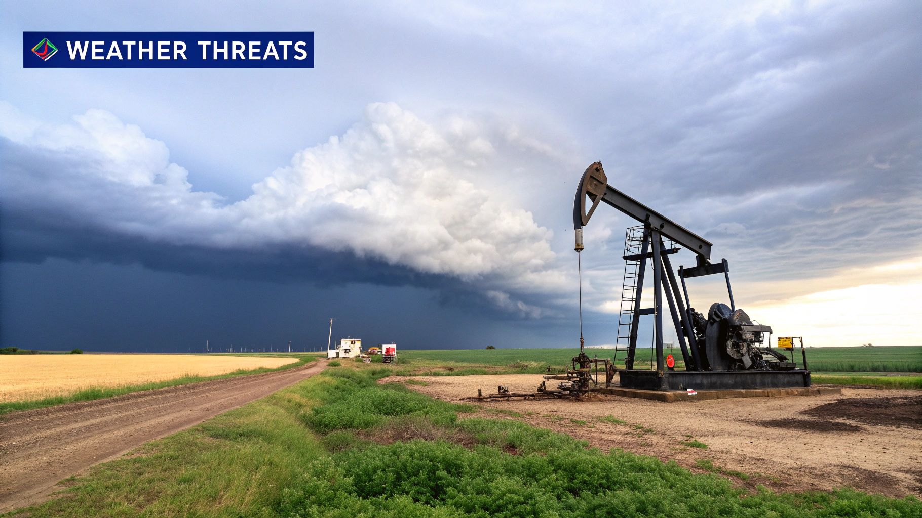
Blocking Patterns and Heat Domes
Another pattern requiring close monitoring is the blocking high, commonly known as a "heat dome." This occurs when a powerful high-pressure ridge becomes stationary over a region for days or weeks, acting like a lid on the atmosphere.
This atmospheric block traps hot air, inhibits cloud formation, and deflects cooler weather systems.
For Texas, a heat dome is not just a series of hot days; it's a prolonged operational crisis. The sinking air within the dome leads to dangerously high surface temperatures that strain the state’s power grid and create life-threatening conditions for outdoor workers in construction, agriculture, and energy sectors.
This pattern was evident in the summer of 2023 when a persistent heat dome resulted in over 40 consecutive days of temperatures exceeding 100°F in parts of the state. This event forced work stoppages and pushed the electrical grid to its limits. This pattern directly threatens operational continuity, employee safety, and energy stability.
The following table breaks down how these major patterns create specific risks for key Texas industries, connecting meteorological forecasts to bottom-line impacts.
Impact of Major Weather Patterns on Texas Industries
| Weather Pattern | Primary Characteristic | Energy & Petrochemical Risk | Agriculture Risk | Construction & Logistics Risk |
|---|---|---|---|---|
| La Niña | Warm & Dry; Active Hurricane Season | Increased risk of hurricane damage to coastal facilities; pipeline disruption. | Severe drought conditions; reduced crop yields; increased irrigation costs. | Port closures due to hurricanes; supply chain disruptions; heat-related work slowdowns. |
| El Niño | Cool & Wet; Increased Flood Risk | Flooding of low-lying facilities; operational disruption from heavy rain. | Delayed planting schedules; crop damage from excessive moisture and flooding. | Significant project delays due to rain; impassable roads; site access issues. |
| Heat Dome | Prolonged Extreme Heat | Power grid instability threatening operations; equipment overheating; cooling system failures. | Extreme water stress on crops and livestock; soil moisture depletion. | Mandatory work stoppages (heat safety); reduced productivity; equipment failure. |
By understanding the distinct threats posed by patterns like La Niña and heat domes, Texas businesses can move from simply reacting to storms to proactively preparing for the specific, predictable risks they present.
How Climate Change Is Intensifying Weather Risks
Historical weather data was once the cornerstone of long-term business planning, providing a reliable operational roadmap. However, the familiar patterns Texas industries have managed for decades are now being amplified by a changing climate.
This shift requires a fundamental update in how businesses assess and prepare for operational threats.
The global climate system can be viewed as an engine that has operated at a relatively stable temperature for generations. Increasing greenhouse gas concentrations are adding more heat to that system. This excess energy does not create new types of weather; it intensifies the patterns we already experience.
A warmer atmosphere holds more moisture—about 7% more for every 1°C of warming. This means that when a storm system forms, it has more available fuel, leading to heavier rainfall and a greater risk of catastrophic flooding that can shut down facilities and disrupt supply chains.
The Data Behind Intensified Patterns
This intensification is not speculative; it is supported by measurable data linking rising global temperatures to the increased severity of weather events.
Since 1924, the global average surface temperature has risen by approximately 1.5°C. NASA data confirms this trend is accelerating, with the 10 warmest years on record all occurring in the last decade. This warming significantly increases the probability of extreme weather.
Sustained warming makes patterns like heat domes not only hotter but also more persistent, resulting in prolonged operational crises for the energy grid and construction sector.
For business leaders, this means a heatwave is no longer just a heatwave, and a hurricane season is no longer just a hurricane season. They are amplified versions of past events, carrying greater potential for disruption and financial loss.
From Precaution to Strategic Necessity
Understanding this intensification is crucial for any forward-looking business strategy. The direct link between a warming climate and more severe weather elevates risk management from a standard precaution to a core component of modern operational planning. For more context on the broader challenges, it's worth exploring research on understanding global warming and its implications.
Basing risk assessments on current climate trends—not outdated historical averages—allows companies to:
- Identify new vulnerabilities in infrastructure and supply chains that were previously considered secure.
- Stress-test operational plans against more severe, yet increasingly likely, weather scenarios.
- Make informed decisions about asset protection and resource allocation before an event occurs.
The connection between climate change and natural disasters is a critical focus for building resilience. Learning more about how climate change influences natural disasters is essential for enhancing operational preparedness.
Accepting that historical performance is no longer a reliable indicator of future weather risk is the first step toward building a truly resilient enterprise in Texas.
Building a Weather-Resilient Business Strategy

Understanding what a weather pattern is provides a solid foundation, but this knowledge becomes valuable only when integrated into operational strategy. This is how businesses build resilience against today’s volatile weather. It requires a shift from a reactive to a proactive mindset, where climate-related risks are actively managed before they materialize.
The starting point must be a comprehensive assessment of your company’s unique vulnerabilities. Every Texas industry has specific pressure points. For a petrochemical facility on the Gulf Coast, the primary threat may be hurricane storm surge. For a manufacturer in North Texas, the most significant risk might be an ice storm that causes a multi-day power outage.
Identifying Your Operational Vulnerabilities
To build a robust strategy, you must pinpoint exactly how and where a weather pattern can disrupt your business. A targeted risk assessment is the most effective way to connect a large-scale atmospheric setup to a direct impact on your bottom line.
Begin by asking critical questions:
- Infrastructure: Which of our key facilities—plants, warehouses, distribution centers—are located in FEMA-designated floodplains or hurricane impact zones?
- Supply Chain: What are our primary logistics corridors? How would a major winter storm or widespread flooding impact our ability to source raw materials or ship finished products?
- Personnel: How does extreme heat from a prolonged heat dome affect the safety and productivity of our outdoor crews in construction or agriculture? Answering these questions provides a clear map of your exposure, enabling a more focused and effective resilience plan. For a deeper dive into structuring this process, our complete guide on creating a business resilience framework is an excellent resource.
From Assessment to Actionable Contingency Planning
Once you’ve mapped your risks, the next step is to develop and stress-test your contingency plans. This extends beyond a simple checklist; it involves creating realistic scenarios based on the intensified weather patterns Texas now experiences. This also includes preparing for specific conditions, such as equipping your logistics fleet with the right training and tips for safe winter driving.
The goal is to build operational muscle memory. A well-rehearsed plan ensures that when a high-impact weather pattern is forecast, your team can execute a coordinated response smoothly and efficiently, minimizing downtime and protecting assets.
A modern approach to preparedness must also account for long-term climate trends. Consider seasonal temperature changes. In the United States, average winter temperatures across the contiguous 48 states have increased by nearly 3°F since 1896, with all other seasons also showing significant warming.
This trend drives more frequent extreme temperature events, making purely historical data an increasingly unreliable guide for future planning. By integrating forward-looking climate data into your strategy, you can build a business that is prepared for both today’s threats and tomorrow’s challenges.
Your Questions Answered: Weather Patterns and Operational Risk
When translating a high-level understanding of weather patterns into a strategic advantage, business leaders often have the same practical questions. Here are direct, operationally focused answers to help connect these concepts to your risk management and planning.
What's The Difference Between A Weather Pattern And The Daily Forecast?
A weather pattern is the "why," while the daily forecast is the "what."
A daily forecast provides specific conditions for a particular location over the next few hours or days—such as the high temperature in Dallas or the probability of rain in Corpus Christi. A weather pattern is the large-scale atmospheric setup that causes those conditions over a broad area and a longer timeframe.
For example, a slow-moving, moisture-rich low-pressure system over the Gulf Coast is the pattern. The resulting daily forecast is three consecutive days of heavy rain and flash flood warnings for Houston. For your business, understanding the pattern offers strategic insight into potential disruptions, while the forecast provides the tactical guidance needed for daily operations.
How Far In Advance Can We Actually Predict These Patterns For Planning?
Predictability depends on the scale of the pattern. The general characteristics of large, seasonal patterns like El Niño or La Niña can be forecast with reasonable confidence several months in advance. This timeframe is ideal for long-range strategic planning, such as preparing for a potentially more active hurricane season or anticipating a drier-than-average winter that could stress water supplies for agriculture.
Shorter-term patterns, such as a developing heat dome, can often be identified one to two weeks out. This provides a critical window to activate contingency plans, whether that involves adjusting work schedules for construction crews or pre-positioning backup generators at manufacturing facilities.
While precise, localized impacts cannot be predicted months ahead, understanding the overarching pattern provides a significant strategic head-start on risk mitigation.
Why Should We Pay More Attention To Weather Patterns Now Than We Did Before?
Because historical data is no longer a reliable guide for future risk. While Texas has always experienced extreme weather, climate change is altering the frequency, intensity, and duration of disruptive events. The operational plans built on historical data are rapidly becoming outdated.
A heat dome today is likely to be hotter and last longer than one 30 years ago, placing unprecedented strain on the electrical grid and employee safety protocols. Paying closer attention now allows you to adapt your risk strategies to this new reality of climate-influenced weather, enhancing the protection of your assets, personnel, and bottom line.
What's A Simple First Step To Assess Our Company's Risks From Weather Patterns?
A practical first step is to conduct a vulnerability mapping exercise.
Identify your most critical business operations, physical assets, and supply chain links. Then, cross-reference them with the major weather patterns discussed in this guide. This internal review helps quickly pinpoint your greatest exposures and lays the groundwork for a more detailed risk management strategy.
Begin by asking questions such as:
- How would a week-long power outage from a summer heat dome impact our manufacturing output?
- Which of our key logistics routes pass through hurricane-prone zones during an active season?
- Are our primary agricultural suppliers located in regions susceptible to prolonged drought during a La Niña phase?
Disclaimer: ClimateRiskNow does not sell insurance or financial products. The information provided is for educational purposes only and should not be construed as financial or operational advice.
Moving from general awareness to a data-driven risk strategy requires location-specific intelligence. ClimateRiskNow delivers detailed, site-specific risk assessments that quantify your operational exposure to hurricanes, flooding, extreme heat, and more. We transform complex meteorological data into actionable decisions. See how by requesting a demo.