
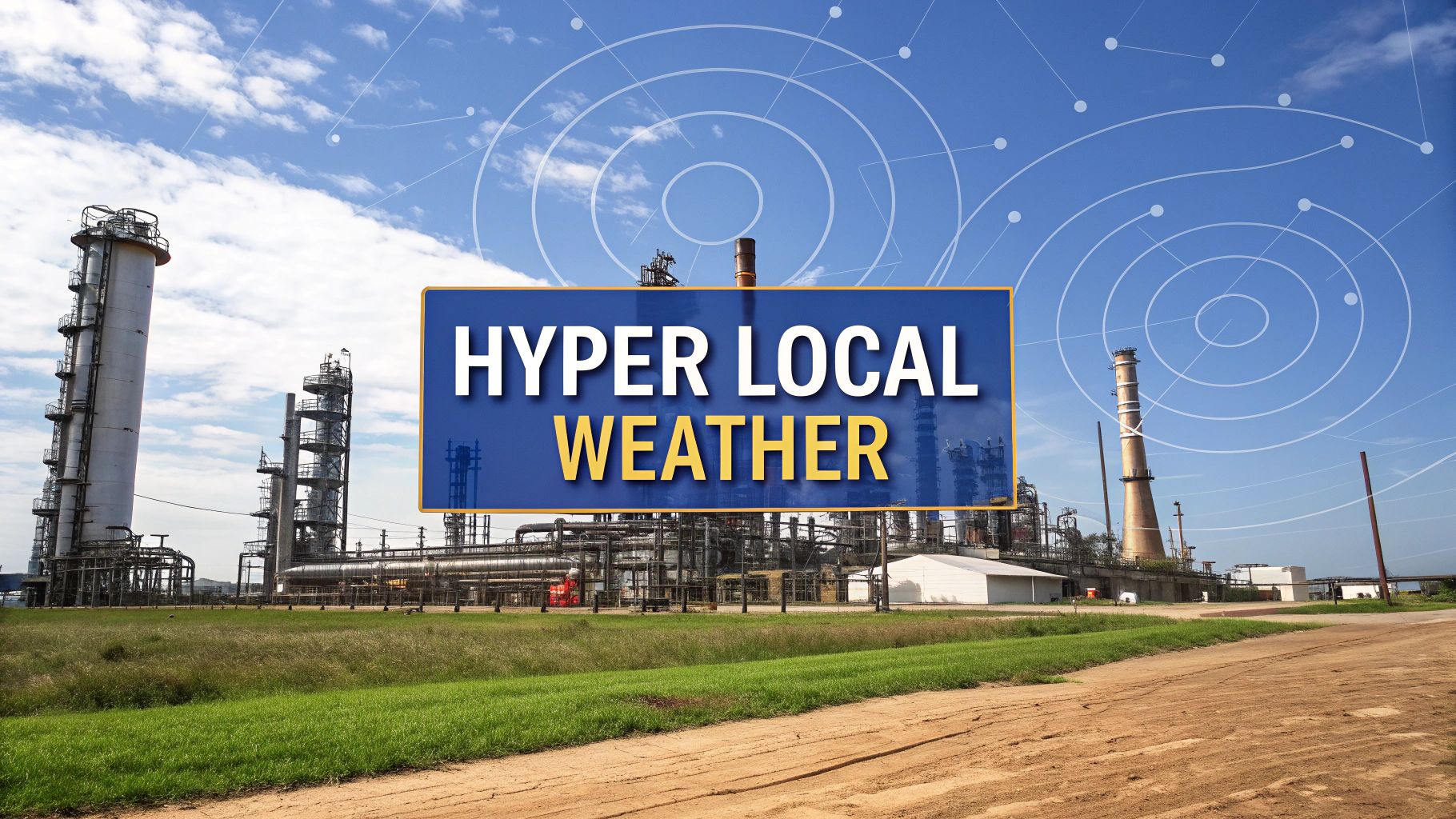
When managing an industrial site in Texas, a standard regional forecast provides a big-picture view but lacks the detail needed for critical operational decisions. For industries where weather dictates risk, this broad approach creates exposure. This is where hyper local weather intelligence delivers real-time, granular data for a precise location—a specific pipeline, a construction site, or an agricultural field. It empowers business leaders to manage operational risks with pinpoint accuracy.
Moving Beyond the Forecast to True Operational Foresight
Think of a standard forecast as a state highway map. It’s useful for the general layout but misses the sudden roadblock on your exact route. Hyper local weather data is more like a live, asset-specific GPS, alerting you to immediate hazards. It can warn about a microburst forming over a construction project or a flash flood threat developing near a logistics hub.
This level of detail allows Texas business leaders to stop reacting to weather events and start proactively managing them. For sectors like Energy & Petrochemical, Manufacturing, Logistics, Agriculture, and Construction—where weather directly impacts safety, productivity, and asset integrity—this foresight is a fundamental part of a modern risk management strategy.
From General Awareness to Actionable Intelligence
The power of hyper local intelligence is its scale and specificity. A regional forecast might give a 30% chance of rain for an entire county, which is interesting but not operationally useful. Hyper local intelligence can predict the exact timing and intensity of that rain over a specific facility, enabling precise, timely adjustments.
Here's what that looks like in practice for Texas industries:
- Energy & Petrochemical: Pausing a sensitive loading operation at a refinery moments before a predicted lightning strike.
- Logistics: Rerouting a fleet of trucks to avoid a highway segment where dangerous crosswinds are projected to develop in the next hour.
- Construction: Securing materials and equipment on a high-rise project an hour before a localized, high-intensity wind gust is expected.
The infographic below illustrates this concept. A tablet displaying a site-specific weather overlay provides a field manager with the foresight needed to make critical on-the-ground decisions.
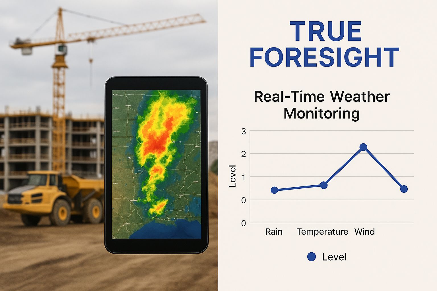
This visual highlights the shift from broad regional awareness to pinpoint operational intelligence. This focus on conditions at an exact location protects assets and personnel, preventing downtime and improving safety.
To see the difference in action, it helps to compare the two approaches side-by-side.
Traditional Forecasts vs. Hyper Local Intelligence
| Feature | Traditional Weather Forecast | Hyper Local Weather Intelligence |
|---|---|---|
| Geographic Scale | Covers a broad region (county, metro area) | Pinpoints a specific location (down to a few hundred feet) |
| Data Resolution | General (e.g., "afternoon storms") | High-resolution (e.g., "heavy rain from 2:15-2:45 PM") |
| Update Frequency | Every few hours | Real-time, minute-by-minute updates |
| Primary Use | General public awareness, daily planning | Operational decision-making, asset protection |
| Actionability | Low; requires interpretation and guesswork | High; provides clear, immediate operational triggers |
This table highlights the fundamental gap between knowing the weather and using weather data to make cost-saving, safety-critical decisions. By understanding the conditions at an exact location, companies can make informed choices that prevent downtime and improve safety. You can explore more applications by reviewing different examples of weather forecasts and how they are applied in various industries.
Disclaimer: ClimateRiskNow provides data-driven insights for educational and operational risk assessment purposes only. We do not sell insurance or provide financial advice. The information provided should not be interpreted as an insurance recommendation or financial advice.
The Technology Driving Pinpoint Weather Accuracy
Achieving street-level weather prediction requires a powerful combination of advanced data collection and sophisticated processing. This isn't just about gathering more data—it's about making that data smarter and more relevant for specific business operations.
The process begins with a massive influx of information from diverse sources. Instead of relying on distant weather stations, these systems pull live data from a dense network of inputs.
Data Sources for Granular Insights
To create a high-resolution weather picture, multiple data types are layered to build a multi-dimensional model of the atmosphere.
- Advanced Radar: Doppler radar provides critical details on precipitation intensity, wind speed, and storm structure, helping to spot fast-developing threats like microbursts.
- Satellite Imagery: Geostationary and polar-orbiting satellites offer a constant overview of atmospheric conditions, enabling the tracking of cloud formations and storm systems across Texas.
- IoT Sensors: Ground-based Internet of Things (IoT) devices, placed at worksites or along critical infrastructure, feed back real-time, on-the-ground measurements of temperature, humidity, and atmospheric pressure.
This constant stream of information creates a detailed view of atmospheric conditions. However, making sense of this data deluge is where the technology truly excels.
The Role of AI and Machine Learning
Artificial intelligence (AI) and machine learning algorithms are the core of the operation. They analyze immense datasets from radar, satellites, and sensors to identify subtle patterns preceding severe weather—patterns often invisible to older forecasting models. AI acts as a master strategist, recognizing the faint atmospheric signals indicating a storm cell is forming directly over a single facility.
By processing countless variables in real time, AI-driven systems can predict microclimates and rapidly evolving threats with remarkable accuracy. They turn weather from an unpredictable force into a manageable operational variable.
This gives Texas businesses a critical edge. For example, integrating AI into forecasting has transformed how weather information is delivered. Meteorological services now create forecasts that adapt on the fly, combining data from IoT sensors and satellites with machine learning to achieve an incredibly fine resolution. You can see more on how The Weather Company is leveraging AI for weather content on weathercompany.com.
These systems go beyond simple forecasting. Advanced approaches, like using AI and Big Data in energy management, demonstrate how these tools create direct operational value. The ability to model these complex interactions sets this technology apart. To understand how these predictions are built, it’s helpful to see how a modern weather computer model works. This proactive approach to risk management is essential for keeping operations running smoothly.
Protecting Assets in Energy and Petrochemicals
In Texas's energy and petrochemical sectors, weather is a direct threat to safety, production, and financial stability. For billion-dollar facilities handling volatile materials, a standard regional forecast is inadequate. Hyper local weather intelligence is essential, providing the site-specific data needed to protect critical assets and personnel.
This level of precision is non-negotiable. A sudden wind shift can turn a routine flare-off into a serious incident, while an unexpected downpour might compromise containment systems. Advance warning of these specific threats allows operators to shift from a reactive to a proactive posture.

From Data Points to Protective Actions
Applying hyper local data is about receiving concrete, actionable triggers that initiate established safety protocols. This data-driven approach removes guesswork from critical decisions when time is of the essence.
Consider these industry-specific scenarios:
- Lightning Strike Prevention: An alert predicts a high probability of a lightning strike within a one-mile radius of a volatile storage tank farm in the next 15 minutes. This immediately triggers a halt to all loading and transfer operations, preventing a potentially catastrophic ignition.
- Pipeline Maintenance Safety: Along a remote pipeline corridor, hyper local forecasts show wind gusts will exceed 40 mph at a specific maintenance point. Crews can stand down from non-essential work, protecting worker safety and preventing equipment damage.
- Refinery Flood Mitigation: An alert warns of a localized microburst—three inches of rain in one hour—expected directly over a critical section of a refinery. This prompts crews to verify drainage systems and secure low-lying equipment, preventing flooding that could lead to extensive damage.
These examples show how pinpoint weather accuracy empowers operational leaders to make timely calls that safeguard assets and lives. It turns weather from an uncontrollable risk into a manageable variable.
A single, well-timed operational halt based on a precise weather alert can prevent millions in damages and avoid significant production losses. This demonstrates the direct value of moving beyond regional forecasts to asset-specific intelligence.
The financial and operational fallout from extreme weather in this sector, underscored by events like Winter Storm Uri, highlights the importance of preparedness. For a detailed analysis, review our report on Winter Storm Uri's effect on the energy sector. By integrating hyper local weather data into daily operations, Texas energy companies can build greater resilience against the state's volatile weather patterns.
Please note: ClimateRiskNow does not sell insurance or financial products. The information provided is for educational purposes only, aimed at helping companies assess and mitigate operational risks.
Building Resilience in Logistics and Manufacturing
In Texas, logistics and manufacturing operate on tight schedules where timing is critical. A single delayed shipment or an unexpected factory shutdown directly impacts the bottom line. Hyper local weather intelligence delivers the street-level foresight needed to shield these operations from disruption.
It’s the difference between a vague county-wide storm warning and a precise, actionable alert for a specific warehouse or highway corridor. This granular detail gives managers the power to make proactive calls that protect assets, maintain supply chain velocity, and ensure production continuity.
Protecting Supply Chains from Gridlock
In logistics, one weather event can trigger a costly domino effect. A flash flood on a critical highway can strand trucks, disrupting delivery schedules and increasing fuel costs. Hyper local data provides fleet managers with a tool to anticipate these problems.
For example, a dispatcher receives an alert for a high probability of flash flooding along a specific five-mile stretch of I-10 within the next hour. They can immediately reroute trucks, achieving three critical outcomes:
- Driver Safety: Crews are kept away from hazardous, fast-changing conditions.
- On-Time Deliveries: Shipments bypass the gridlock, maintaining service levels.
- Reduced Costs: Trucks avoid idling in traffic, saving significant fuel.
This precision is essential for building a more reliable and cost-effective supply chain. For a deeper dive, explore our guide on improving supply chain resilience against extreme weather.
Optimizing Manufacturing Plant Operations
Within a manufacturing plant, extreme weather creates risks for personnel and machinery. An intense heat wave can cause health issues for employees and push equipment past safe operating limits, risking breakdowns and expensive repairs.
With hyper local forecasts, a plant manager can anticipate an extreme heat wave at their specific facility 48 hours in advance. This warning allows them to pre-cool the building, adjust production schedules to avoid the hottest parts of the day, and implement additional safety measures for workers.
This proactive approach protects employee well-being while preventing unplanned shutdowns and maintaining productivity. By integrating weather data into core planning, Texas manufacturers can build a more resilient and efficient operation prepared for the state's climate realities.
Disclaimer: ClimateRiskNow does not offer insurance or financial products. All information is provided for educational and risk assessment purposes. It should not be considered financial advice or an insurance recommendation.
Securing Operations in Agriculture and Construction
In Texas, the success of agriculture and construction hinges on daily weather conditions. A standard regional forecast offers a general outlook, but hyper local weather intelligence provides the sharp, actionable detail needed to protect a harvest, ensure crew safety, and maintain project momentum. It reframes weather from an uncontrollable threat to a manageable operational variable.
This precision is vital when managing expensive resources and protecting high-value assets. A small, intense storm missed by a broader forecast can cause significant financial losses, underscoring the case for site-specific data.

Precision Agriculture for a Resilient Harvest
Water is a critical and costly resource in farming. Hyper local data allows Texas farmers to replace guesswork with precise irrigation strategies that conserve water and optimize crop yields.
For example, real-time soil moisture readings for a specific corner of a field enable a farmer to apply the exact amount of water needed, preventing waste and crop stress. A targeted alert for a fast-moving hailstorm provides a critical window to deploy protective covers over high-value crops, potentially saving a season's work from being destroyed in minutes. These data-driven practices align with guidance from agencies like the Texas Commission on Environmental Quality (TCEQ) on water conservation.
Enhancing Safety and Efficiency on the Job Site
Construction sites are dynamic environments where weather can turn quickly, creating immediate safety risks and logistical challenges. A sudden, powerful wind gust can make crane operations dangerous. An unexpected downpour can ruin a fresh concrete pour, forcing costly rework.
With hyper local weather insights, a site manager can receive an alert for dangerous wind gusts expected at their high-rise project in the next hour. This allows ample time to pause crane lifts and secure materials, protecting personnel and equipment in compliance with OSHA guidelines.
By forecasting a localized downpour with pinpoint accuracy, crews can schedule concrete pours to avoid the rain, preventing material loss and keeping the project on schedule and budget.
This capability is particularly important in urban areas. Urban flooding, often caused by intense, localized storms that traditional forecasts miss, is a growing problem. By integrating data from ground sensors and radar, construction firms can apply the same principles used in municipal flood management to protect their job sites. You can learn more about the essential role of hyperlocal data in managing urban flooding from Vaisala.
These specific actions, driven by precise data, lead directly to safer worksites, reduced material waste, and more reliable project timelines.
Disclaimer: ClimateRiskNow provides data-driven insights for educational and operational risk assessment purposes only. We do not sell insurance or provide financial advice.
Integrating Weather Data into Your Risk Framework
Acquiring better weather data is a crucial first step, but the greatest value comes from integrating those hyper local insights directly into your company's operational framework. The goal is to move from simply knowing what the weather might do to being proactively prepared.
This process begins with an assessment of your unique vulnerabilities. A logistics company's biggest risk might be a specific highway segment prone to flash flooding. For a construction firm, it could be the exact wind speed that makes crane operations unsafe.
Once you have identified these critical sensitivities, you can build a system that links hyper local weather alerts to specific, predetermined actions.
Building an Actionable System
The objective is to create clear, automated triggers that enable immediate team response, removing guesswork during a critical weather event.
- Define Thresholds: Establish the exact weather conditions that require a response, such as wind speeds exceeding 45 mph or hail reaching 1 inch in diameter.
- Develop Protocols: For each trigger, map out a clear, step-by-step action plan. Define roles and responsibilities to ensure a coordinated response.
- Automate Alerts: Use API integrations to feed weather data directly into existing management systems, ensuring the right alerts reach the right people without delay.
The effectiveness of this system depends on the quality of the data feeding it. For a deeper understanding of ensuring data integrity, review these essential data quality best practices.
Fostering a culture of proactive risk management means empowering every team member with the information and authority to act. When an automated alert is received, the subsequent safety protocol should be an immediate, practiced reflex.
The global demand for hyper local weather data is growing precisely because it sharpens these operational decisions. Leading providers offer APIs and historical databases, giving companies real-time access to the precise forecasts and historical data needed to build robust risk models.
Developing this framework requires the right analytical tools. Our guide on climate risk assessment tools can help you identify resources that align with your organization's specific needs.